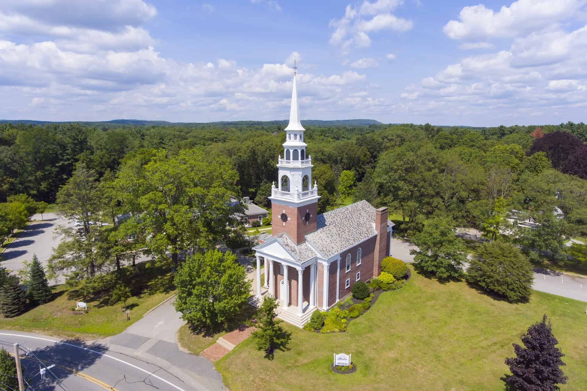
Welcome to Framingham
Framingham is a vibrant town located in Middlesex County, Massachusetts, just 20 miles west of Boston. With a population of approximately 75,000 residents, Framingham is the largest town in Massachusetts and serves as a hub for business, transportation, and education in the region. The town is home to a diverse community, including a large number of young professionals, families, and retirees.
Framingham boasts a rich history, dating back to the 17th century, and offers a variety of cultural and recreational opportunities for residents and visitors alike. From the picturesque Sudbury River to the scenic Callahan State Park, outdoor enthusiasts will find plenty of activities to enjoy in Framingham. Additionally, the town is home to several museums, art galleries, and cultural centers that showcase the area's history and diversity. With its prime location, rich history, and diverse community, Framingham is a wonderful place to live, work, and explore.
Key Details
Settled - 1650
Incorporated (town) - June 25, 1700
Incorporated (city) - January 1, 2018
County - Middlesex
Zip code - 01701
Area
Total 26.50 sq mi (68.65 km2)
Land 25.04 sq mi (64.86 km2)
Water 1.46 sq mi (3.78 km2)
Population (2020)
Total - 72,362
Density - 2,889.39/sq mi (1,115.61/km2)
Resources
-
Prior to European colonization, the region around Framingham was inhabited by the indigenous Nipmuc. They lived in settlements established alongside the Washakamaug (“eel fishing place”) or what is today called Farm Pond. The Nipmuc people used game management techniques through the hunting of deer and beaver, fishing in ponds and streams, as well as established growing areas for the Three Sisters (squash, corn, beans) in the nearby hills. The ancient Native trail later known as the Old Connecticut Path also ran through this area. During the initial period of colonization of the region by Puritan settlers, the Nipmuc suffered a rapid decline in population due to the introduction of foreign infectious diseases to which they had no immunity and violence related to settler colonialism. Many of the Nipmuc people were forced into praying towns including nearby Natick.
The first European settler in the area was John Stone who established a farm on the west bank of the Sudbury River in 1647. In 1660, Thomas Danforth, an official of the Bay Colony received a grant of land at "Danforth's Farms" and began to accumulate over 15,000 acres (100 km2).
Between 1675-1676, King Philip's War created great tensions between English settlers and the Nipmuc people in the area. During this time, Nipmuc leader Tantamous, who lived on Nobscot Hill and who resisted Christianization by the English, was arrested with his family members and other Nipmuc men by the colonial government in 1676 for what the colony deemed treason and they were incarcerated on Deer Island. He would escape, be recaptured, and later hung on Boston Common. In January 1676, a group of Nipmuc men went to the Eames family homestead to demand that they return a stolen corn harvest. Although the historical record is unclear as to the exact details, this would result in an outbreak of violence between the Nipmuc men and the Eames family, where Mary Eames and five children were killed.
As more settlers moved to the town, it would be named Framingham after Thomas Danforth's hometown in England. Over time, Thomas Danforth strenuously resisted petitions for incorporation of the town, which was officially incorporated in 1700, following his death the previous year. Why the "L" was dropped from the new town's name is not known. The first church was organized in 1701, the first teacher was hired in 1706, and the first permanent schoolhouse was built in 1716.
On February 22, 1775, the British general Thomas Gage sent two officers and an enlisted man out of Boston to survey the route to Worcester, Massachusetts. In Framingham, those spies stopped at Buckminster's Tavern. They watched the town militia muster outside the building, impressed with the men's numbers but not their discipline. Though "the whole company" came into the tavern after their drill, the officers remained undetected and continued on their mission the next day. Gage did not order a march along that route, instead ordering troops to Concord, Massachusetts, on April 18–19. Framingham sent two militia companies totaling about 130 men into the Battles of Lexington and Concord that followed; one of those men was wounded.
In the years before the American Civil War, Framingham was an annual gathering-spot for members of the abolitionist movement. Each Independence Day from 1854 to 1865, the Massachusetts Anti-Slavery Society held a rally in a picnic area called Harmony Grove near what is now downtown Framingham. At the 1854 rally, William Lloyd Garrison burned copies of the Fugitive Slave Law of 1850, judicial decisions enforcing it, and the United States Constitution. Other prominent abolitionists present that day included William Cooper Nell, Sojourner Truth, Wendell Phillips, Lucy Stone, and Henry David Thoreau.
During the post-World War II baby boom, Framingham, like many other suburban areas, experienced a large increase in population and housing. Much of the housing constructed during that time consisted of split-level and ranch-style houses.
Framingham is known for the Framingham Heart Study, as well as for the Dennison Manufacturing Company, which was founded in 1844 as a jewelry and watch box manufacturing company by Aaron Lufkin Dennison, who became the pioneer of the American System of Watch Manufacturing at the nearby Waltham Watch Company. His brother Eliphalet Whorf Dennison developed the company into a sizable industrial complex which merged in 1990 into Avery Dennison, with headquarters in Pasadena, California, and active corporate offices in the town.
In 2000, Framingham celebrated its Tercentennial. Framingham soon rose to become the largest town in Massachusetts, commonly referred to by the people of Framingham as "The largest town in the country." Framingham had attempted to become a city on three prior occasions 1993, 1997, and 2013, all of which were rejected by the people of Framingham. However, on January 1, 2018, Framingham became a city and Yvonne M. Spicer was inaugurated as its first mayor, thus becoming the first popularly elected African-American female mayor in Massachusetts.
-
Culture
Amazing Things Arts Center
Framingham Community Theater
Framingham History Center (formerly the Framingham Historical Society and Museum)
Danforth Museum
Metrowest Youth Symphony Orchestra
Pike Haven Homestead was built in 1693 by Jeremiah Pike. He and his descendants were town and militia officers, yeomen, and makers of spinning wheels in the colonial period. This house had been occupied by the same family for eight generations.
Parks
Bowditch Field is Framingham's main athletic facility. It is on Union Avenue midway between Downtown and Framingham Center and was the main athletic facility for the town. It houses a large multi-purpose football stadium that included permanent bleachers on both sides of the field. There is still a baseball field, tennis courts, a track and field practice area, and the headquarters of the city Parks Department. Bowditch, along with Butterworth and Winch Parks, were all built during the Great Depression of the 1930s as WPA projects. It underwent a complete renovation/reconstruction in 2010. It is also the current site of Framingham High's graduation ceremony.
Butterworth Park is at the corner of Grant St and Arthur St. The park occupies a square block near downtown. The park has a baseball stadium that includes permanent bleachers on one side of the field, a basketball court and a tennis court. There is street parking on three sides. The bleachers have since been taken down.
Winch Park is the sister park to Butterworth and is in Saxonville next to the Framingham High School. It includes a baseball stadium that includes permanent bleachers on one side of the field, a basketball court, tennis courts and two large practice fields used for football, soccer and lacrosse. There are two additional multi-use fields on the other side of the high school's gymnasium building.
Callahan State Park is a large state park run by the DCR located in North Framingham in the city's northwest corner.
Cochituate State Park on Lake Cochituate has a small section in Framingham where Saxonville Beach is on the north western shore of the lake.
Danforth Park on Danforth Street, not far from the Wayland town line. The small park has playground with a half basketball court and a small baseball/kickball field.
Framingham Common is in Framingham Center in front of the old Town Hall along Edgell Road and Vernon Street. It features an outdoor stage for concerts and other fair weather events. It is a favorite of the students of Framingham State University, and the site of their annual graduation ceremonies.
Cushing Park on the South Side is a passive recreational area. The Framingham Peace and 9/11 Memorials are within the park across the street from Farm Pond, along with the Cushing Chapel. During World War II, the United States War Department constructed the Cushing General Hospital (named for Dr. Harvey Cushing) on this site; the chapel was part of the hospital complex. After the Korean War the hospital was sold to the Commonwealth of Massachusetts for use as a geriatric hospital. After the hospital was closed in 1991, the land was converted into a 57-acre public park.
Long Athletic Complex On the south side of Framingham, near downtown the complex is the host of three little league baseball diamonds (Carter, Tusconi, Merloni), two Babe Ruth baseball fields (one being Long field), a softball field, outdoor basketball court, and two concession stands. The complex is surrounded by Keefe Tech High School, Loring Arena, and Barbari Elementary School. All of the fields have lights, and they host almost all of Framingham's Little League games. Long field is the host of JV high school games as well as most Framingham Babe Ruth games. The concession stands are both non-profit and all the money goes to the Framingham baseball league.
Conservation land
Framingham has about 400 acres (1.6 km2) of land that has been placed into public conservation.
The Wittenborg Woods was donated to the town in 1999 by Harriet Wittenborg. The properties were originally purchased from Henry Ford in the 1940s. Henry Ford owned all of the land around the Wayside Inn in nearby Sudbury, and Harriet (and her husband) were required to interview with Mr. Ford to determine if they would be good stewards of the land.
The Morency Woods is a parcel of land that is physically located in Natick, Massachusetts on the Framingham border, but which is owned by the City of Framingham. This forested land was used as a sewer bed up until the mid-1940s and was placed into conservation in 2001.
The Sudbury Valley Trustees has approximately 200 acres (0.8 km2) of land in North Framingham and along the Sudbury River in a private conservation trust.
Recreation
Garden in the Woods, operated by the New England Wild Flower Society,[134] is a botanical garden that features the largest landscaped collection of native wildflowers in New England. It is in Nobscot, off of Hemenway Road.
Framingham Country Club, along Salem End Road on the South Side, is a private club that features an 18-hole course with 6,580 yards (6,017 m) of golf from the longest tees for a par of 72.
Millwood Farms Golf Course off Millwood Street was a public 14-hole, par 53 golf course. Originally a 9-hole course, it was expanded to 14 holes in the late 1970s. Attempts to purchase land for a full 18-hole were unsuccessful. Millwood Farms Golf Course was closed in 2018 to make way for a new housing development.
Nobscot Scout Reservation is a private facility owned by the Knox Trail Council[135] of the Boy Scouts of America and is open to the public during most of the year.
The city has several public beaches including Saxonville beach on Lake Cochituate, Washakum Beach on Lake Washakum, and the beach at Learned Pond.
The former Cushing hospital grounds serve as walking, biking, rollerblading, and picnic areas.
Farm Pond in South Framingham once used to host Fourth of July Fireworks, now is a picnic area.
Edward F. Loring Skating Arena,near Farm Pond at the corner of Fountain and Dudley Roads, is a municipal skating arena for area groups on a rental basis and public skating and stick time is available September through April.
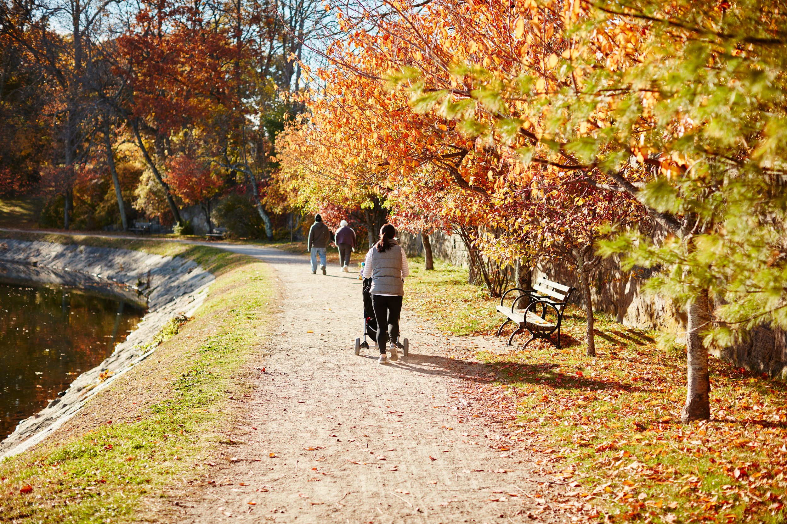
The Cochituate Rail Trail is a 3.6 mile, multi-use trail for walkers, joggers and bikers that runs from the Village of Saxonville in Framingham to Natick Center. While the Framingham section opened in 2015, the entire length of the trail opened to the public in 2021.
-
The Framingham School Department can trace its roots back to 1706 when the town hired its first schoolmaster, Deacon Joshua Hemenway. Although Framingham had its first schoolmaster, it did not get its own public school building until 1716. The first high school, the Framingham Academy, opened its doors in 1792; however, this school was eventually closed due to financing issues and the legality of the town providing funds for a private school. The first town-operated high school opened in 1852 and has been in operation continuously in numerous locations throughout the town.
Framingham has 14 public schools which are part of the Framingham Public School District.This includes Framingham High School, three middle schools (Walsh, Fuller, and Cameron), nine elementary schools (Barbieri, Brophy, Dunning, Hemenway, King, McCarthy, Potter Road, Stapleton, Woodrow Wilson), and the Blocks Pre-School. The school district's main offices are located in the Fuller Administration Building on Flagg Drive with additional offices at the King School on Water Street. The city also has a regional vocational high school and one regional charter school. Framingham is also home to several private schools, including Summit Montessori School, the Sudbury Valley School, one parochial school, one Jewish day school, and several specialty schools.
Since 1998, when Framingham began upgrading its schools, it has performed major renovations to Cameron, Wilson, McCarthy, and Framingham High School. Two public school buildings that were mothballed due to financial issues or population drops have been leased to the Metrowest Jewish Day School (at the former Juniper Hill Elementary) and Mass Bay Community College (at the former Farley Middle school). Several schools that were no longer being used were sold off, including Lincoln, Roosevelt, and Washington.
Framingham has three colleges, including Framingham State University and Massachusetts Bay Community College's Framingham Campus.

Properties on Market in Framingham
Location

Framingham lies in the south of Middlesex County. It is bordered on the south by Ashland and Sherborn, on the east by Natick and Wayland on the north by Sudbury, on the north by Marlborough and Southboro. Framingham lies 22 miles west of Boston and 27 miles east of Worcester.
Check out other communities we service
Boston Neighborhoods
Back Bay, South End, Downtown, Fenway, South Boston, Seaport, East Boston, Allston, Brighton, Jamaica Plain, West Roxbury, Roslindale
North Shore
Swampscott, Marblehead, Salem, Peabody, Lynnfield, Wakefield, Reading, North Reading, Middleton, Danvers, Beverly, Manchester by the Sea, Gloucester, Rockport, Essex, Ipswich, Hamilton, Wenham, Topsfield, Boxford, North Andover, Andover
North of Boston
Cambridge, Somerville, Winchester, Medford, Malden, Melrose, Stoneham, Woburn, Saugus, Arlington, Lexington, Belmont, Burlington, Wilmington
West of Boston (Metrowest)
Brookline, Newton, Weston, Wellesley, Sudbury, Wayland, Lincoln, Waltham, Watertown, Dedham, Needham, Sudbury, Framingham, Natick, Westborough, Southborough, Marlborough, Hudson, Ashland, Dover
*content on this page is a mixture of original and pulled from multiple locations including Wikepedia